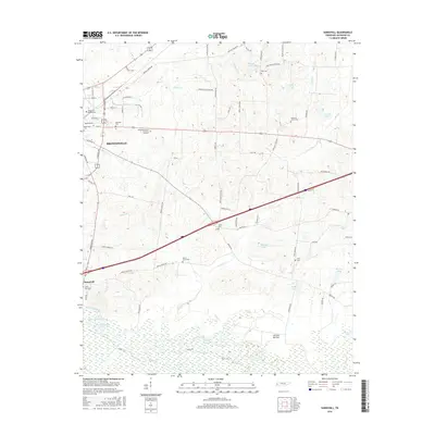
2016 Map of Sunnyhill
USGS Topo · Published 2016About this map
The eastern periphery of Brownsville and the rural community of Sunnyhill are the primary focus of this Tennessee landscape. This area is notably characterized by a high concentration of burial grounds, including the Magnolia Cem, Knights of Pythias Cem, and Rosenwald Cem, offering significant data for genealogical research. The southern portion of the quadrangle is dominated by the sprawling wetlands of Hatchie Bottom and the winding course of the Hatchie River. This riparian environment is punctuated by numerous named oxbows and backwaters, such as Hart Lake Number One, Hart Lake Number Two, and Powell Lakes, which suggest the historical shifts of the river's path through the bottomlands. To the east, rural landmarks like Brickyard Pond and the Chestnut Grove Cem highlight the scattered nature of settlement and industry outside the central hub.
Find a feature on this map
84 named features on this map. Tap any name to fly to it.
Don’t see what you’re looking for? This feature index may not catch every label — zoom into the map to look around manually.
Map Details
Editions of this 2016 Sunnyhill Map
This is the sole edition of this map. No revisions or reprints were ever made.
Other maps of this area

1950 · Sunnyhill
USGS Topo · 1:24,000

1950 · Brownsville
USGS Topo · 1:24,000

1951 · Brownsville
USGS Topo · 1:24,000

1951 · Sunnyhill
USGS Topo · 1:24,000

1952 · Dancyville
USGS Topo · 1:24,000

1952 · Stanton
USGS Topo · 1:62,500

1956 · Blytheville
USGS Topo · 1:250,000

1959 · Blytheville
USGS Topo · 1:250,000

1959 · Bells
USGS Topo · 1:24,000

1959 · Denmark
USGS Topo · 1:24,000