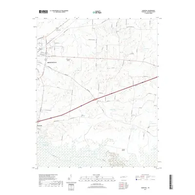
2019 Map of Sunnyhill
USGS Topo · Published 2019About this map
Brownsville serves as the primary urban center in this West Tennessee landscape, where the street grid transitions into a complex network of rural roads and watercourses. The local drainage pattern is defined by several small tributaries and basins, including Little Nixon Cr and Sugar Br. These waterways feed into various local impoundments such as Holt Lake, Cobb Cr Lake, and Powell Lake, which are characteristic of the agricultural and residential land use in Haywood County. The map provides a clear picture of how modern infrastructure and residential expansion from the county seat intersect with the traditional creek-fed lowlands. The southern settlement of Sunnyhill stands as a distinct community focal point amidst the surrounding farms and woodlands, illustrating the persistent importance of smaller crossroads hamlets in the region's geographic layout.
Find a feature on this map
7 named features on this map. Tap any name to fly to it.
Don’t see what you’re looking for? This feature index may not catch every label — zoom into the map to look around manually.
Map Details
Editions of this 2019 Sunnyhill Map
This is the sole edition of this map. No revisions or reprints were ever made.
Other maps of this area

1950 · Sunnyhill
USGS Topo · 1:24,000

1950 · Brownsville
USGS Topo · 1:24,000

1951 · Brownsville
USGS Topo · 1:24,000

1951 · Sunnyhill
USGS Topo · 1:24,000

1952 · Dancyville
USGS Topo · 1:24,000

1952 · Stanton
USGS Topo · 1:62,500

1956 · Blytheville
USGS Topo · 1:250,000

1959 · Blytheville
USGS Topo · 1:250,000

1959 · Bells
USGS Topo · 1:24,000

1959 · Denmark
USGS Topo · 1:24,000