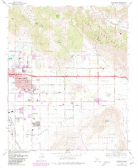
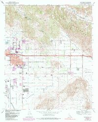
1967 Map of Sunnymead
USGS Topo · Published 1980About this map
Sunnymead and Moreno serve as the primary hubs in this Riverside County landscape, which shows significant urban expansion near the northern edge of March Air Force Base. The transition from the rugged foothills of The Badlands and Mt Russell into the flatter San Jacinto Valley is defined by a grid of agricultural and residential streets, many bearing botanical names like Eschscholtzia Avenue and Delphinium Ave.
Find a feature on this map
45 named features on this map. Tap any name to fly to it.
Don’t see what you’re looking for? This feature index may not catch every label — zoom into the map to look around manually.
Map Details
Editions of this 1967 Sunnymead Map
5 editions found
Other maps of this area

1896 · San Bernardino
USGS Topo · 1:62,500

1898 · San Bernardino
USGS Topo · 1:62,500

1899 · Redlands
USGS Topo · 1:62,500

1901 · Southern California Sheet No. 1
USGS Topo · 1:250,000

1901 · San Bernardino
USGS Topo · 1:62,500

1901 · Redlands
USGS Topo · 1:62,500

1901 · Elsinore
USGS Topo · 1:125,000

1901 · Riverside
USGS Topo · 1:62,500

1904 · Southern California Sheet No. 1
USGS Topo · 1:250,000
1938 · Colton
USGS Topo · 1:31,680