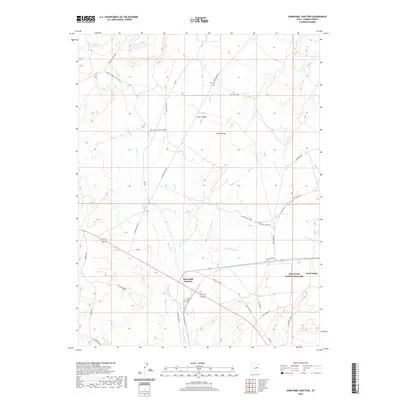
2020 Map of Sunnyside Junction
USGS Topo · Published 2020About this map
Clark Valley defines the central geography of this Carbon County landscape, where the high desert terrain is etched by drainage systems like Grassy Trail Cr and Rock Cr. The map captures the intersection of ranching history and local industry, marked by the City of East Carbon-Sunnyside and the high-altitude Big Springs Ranch. The road network reveals the area's practical orientation, with routes like Clark Valley Maze Rd and Loco Flats Rd providing access across the varied topography. Genealogists and local historians can pinpoint the location of Kiz Cem and the settlement at Sunnyside Junction. To the south, water management is evident at Spider Reservoir, while the northern reaches transition into the steep walls of Rock Canyon and the descriptive Oil Well Draw, reflecting the long-standing extraction and agricultural identity of this Utah region.
Find a feature on this map
38 named features on this map. Tap any name to fly to it.
Don’t see what you’re looking for? This feature index may not catch every label — zoom into the map to look around manually.
Map Details
Editions of this 2020 Sunnyside Junction Map
This is the sole edition of this map. No revisions or reprints were ever made.
Other maps of this area

1886 · Price River
USGS Topo · 1:250,000

1896 · Price River
USGS Topo · 1:250,000

1915 · Sunnyside
USGS Topo · 1:62,500

1915 · Wellington
USGS Topo · 1:62,500

1948 · Woodside
USGS Topo · 1:62,500

1949 · Woodside
USGS Topo · 1:62,500

1950 · Woodside
USGS Topo · 1:62,500

1956 · Price
USGS Topo · 1:250,000

1960 · Price
USGS Topo · 1:250,000

1962 · Price
USGS Topo · 1:250,000