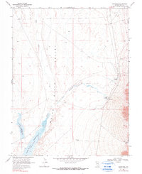
1969 Map of Sunnyside
USGS Topo · Published 1990About this map
The White River Valley landscape in this 1960s survey is defined by the management of water in an arid environment. The settlement of Sunnyside serves as a focal point near the intersection of Sunnyside Creek and several natural water sources, including Butterfield Springs and Flag Springs. This area shows a transition from natural watercourses like the White River to man-made infrastructure designed for storage and livestock, most notably the Dacey Reservoir and the Adams-Mc Gill Reservoir.
Find a feature on this map
14 named features on this map. Tap any name to fly to it.
Don’t see what you’re looking for? This feature index may not catch every label — zoom into the map to look around manually.
Map Details
Editions of this 1969 Sunnyside Map
2 editions found
Other maps of this area

1956 · Lund
USGS Topo · 1:250,000

1960 · Lund
USGS Topo · 1:250,000

1969 · Gap Mountain
USGS Topo · 1:24,000

1969 · Shingle Pass
USGS Topo · 1:24,000

1969 · Sunnyside
USGS Topo · 1:24,000

1969 · Moorman Spring SE
USGS Topo · 1:24,000

1969 · Hot Creek Butte
USGS Topo · 1:24,000

1969 · Sunnyside NW
USGS Topo · 1:24,000

1969 · Moorman Spring
USGS Topo · 1:24,000

1971 · Cave Valley Well
USGS Topo · 1:24,000