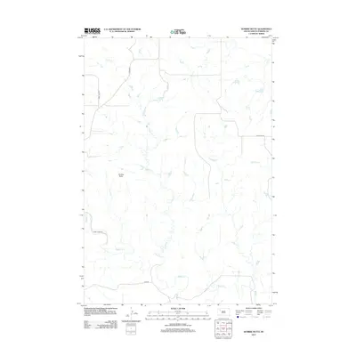
2012 Map of Sunrise Butte
USGS Topo · Published 2012About this map
Sunrise Butte rises as the central topographic landmark in this Perkins County landscape, which is defined by a dendritic network of prairie drainages. The area is characterized by the meandering courses of Indian Cr in the north and the prominent Rabbit Cr in the south, while Porcupine Cr cuts through the eastern reaches. This 2012 survey illustrates a sparsely settled region where transportation is dictated by long-distance rural routes such as Chance Rd and Usta Rd. The map provides a clear look at how human infrastructure, including Happy Hill Rd and Rabbit Creek Rd, follows the natural contours and valley floors of the creek systems, reflecting a landscape still deeply tied to its hydrological patterns and open-range geography.
Find a feature on this map
9 named features on this map. Tap any name to fly to it.
Don’t see what you’re looking for? This feature index may not catch every label — zoom into the map to look around manually.
Map Details
Editions of this 2012 Sunrise Butte Map
This is the sole edition of this map. No revisions or reprints were ever made.
Other maps of this area

1951 · Deep Creek NW
USGS Topo · 1:24,000

1952 · Deep Creek NE
USGS Topo · 1:24,000

1952 · Faith NW
USGS Topo · 1:24,000

1954 · Lemmon
USGS Topo · 1:250,000

1957 · Lemmon
USGS Topo · 1:250,000

1983 · Sunrise Butte
USGS Topo · 1:24,000

1983 · Coal Springs SW
USGS Topo · 1:24,000

1983 · Owen Lake
USGS Topo · 1:24,000

1983 · Coal Springs NW
USGS Topo · 1:24,000
1983 · Chance
USGS Topo · 1:24,000