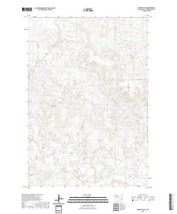
2021 Map of Sunrise Butte
USGS Topo · Published 2021About this map
Sunrise Butte rises as the dominant landmark of this Perkins County landscape, defining the topography between the drainages of Rabbit Cr and Indian Cr. This 2021 survey illustrates a sparse, ranching-oriented region of South Dakota where section lines and local connectors like Owen Lake Rd and Happy Hill Rd provide the primary infrastructure. The meandering course of Porcupine Cr cuts across the eastern reaches of the quadrangle, reflecting the drainage patterns common to the northern plains. Land use is organized around the Public Land Survey System, with Township 15 and 16 North and Ranges 14 and 15 East providing the structural framework for the rural properties and vast open country of the area.
Find a feature on this map
3 named features on this map. Tap any name to fly to it.
Don’t see what you’re looking for? This feature index may not catch every label — zoom into the map to look around manually.
Map Details
Editions of this 2021 Sunrise Butte Map
This is the sole edition of this map. No revisions or reprints were ever made.
Other maps of this area

1951 · Deep Creek NW
USGS Topo · 1:24,000

1952 · Deep Creek NE
USGS Topo · 1:24,000

1952 · Faith NW
USGS Topo · 1:24,000

1954 · Lemmon
USGS Topo · 1:250,000

1957 · Lemmon
USGS Topo · 1:250,000

1983 · Sunrise Butte
USGS Topo · 1:24,000

1983 · Coal Springs SW
USGS Topo · 1:24,000

1983 · Owen Lake
USGS Topo · 1:24,000

1983 · Coal Springs NW
USGS Topo · 1:24,000
1983 · Chance
USGS Topo · 1:24,000