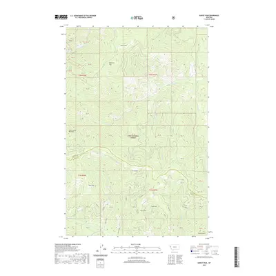
2020 Map of Sunset Peak
USGS Topo · Published 2020About this map
Lolo National Forest encompasses the high ridgelines and drainages of the Coeur d'Alene Mountains along the border of Sanders and Mineral counties. This modern topographic survey highlights a vertical landscape dominated by Sunset Peak and Sacajawea Peak, where the C-C Divide separates complex watersheds. The map details an intricate network of forest roads and trails, many with distinctive informal names like Kansas City, Bad Apple, and Grumpy. These routes traverse significant elevation changes between summits like Drury Peak and deep drainage basins including Long Gulch and Graham Gulch. In the lower elevations, water features such as Swamp Lake and the various branches of W Fork Swamp Cr provide the primary geographic markers within the dense forest canopy.
Find a feature on this map
56 named features on this map. Tap any name to fly to it.
Don’t see what you’re looking for? This feature index may not catch every label — zoom into the map to look around manually.
Map Details
Editions of this 2020 Sunset Peak Map
This is the sole edition of this map. No revisions or reprints were ever made.
Other maps of this area

1918 · St Regis
USGS Topo · 1:125,000

1919 · St. Regis
USGS Topo · 1:125,000

1937 · Thompson Falls
USGS Topo · 1:125,000

1956 · St Regis
USGS Topo · 1:62,500

1956 · Wallace
USGS Topo · 1:250,000

1959 · Plains
USGS Topo · 1:62,500

1960 · Wallace
USGS Topo · 1:250,000

1964 · Eddy Mountain
USGS Topo · 1:24,000
1964 · Big Hole Peak
USGS Topo · 1:24,000

1964 · Weeksville
USGS Topo · 1:24,000