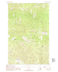
1988 Map of Sunset Peak
USGS Topo · Published 1988About this map
The Lolo National Forest dominates this landscape along the border of Sanders Co and Mineral Co, where high summits like Sacajawea Peak and Sunset Peak overlook a complex network of drainage systems. The C C Divide serves as a prominent geographic spine, separating the headwaters of numerous streams including Swamp Creek and Dry Fork. This 1980s terrain is marked by remnants of early exploration, such as a Prospect located along a West Fork Creek tributary and several traditional routes labeled as Pack Trail. The topography transitions from the high elevations of Drury Peak and Olson Peak down into lower-lying areas like Burnt Flats and Long Gulch. The northern edge is anchored by Swamp Lake, providing a clear focal point for the surrounding Eddy Creek drainage. This survey represents a specific moment in the management of Montana's mountain wilderness, highlighting the intersection of natural water courses and established administrative forest boundaries.
Find a feature on this map
21 named features on this map. Tap any name to fly to it.
Don’t see what you’re looking for? This feature index may not catch every label — zoom into the map to look around manually.
Map Details
Editions of this 1988 Sunset Peak Map
This is the sole edition of this map. No revisions or reprints were ever made.
Other maps of this area

1918 · St Regis
USGS Topo · 1:125,000

1919 · St. Regis
USGS Topo · 1:125,000

1937 · Thompson Falls
USGS Topo · 1:125,000

1956 · St Regis
USGS Topo · 1:62,500

1956 · Wallace
USGS Topo · 1:250,000

1959 · Plains
USGS Topo · 1:62,500

1960 · Wallace
USGS Topo · 1:250,000

1964 · Eddy Mountain
USGS Topo · 1:24,000
1964 · Big Hole Peak
USGS Topo · 1:24,000

1964 · Weeksville
USGS Topo · 1:24,000