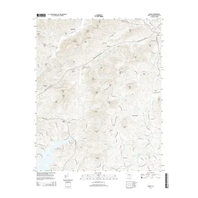
2014 Map of Sunset
USGS Topo · Published 2014About this map
Nimmons and Sunset anchor the northern landscape of Pickens County, where the Blue Ridge foothills begin their ascent toward Sharp Top Mtn. The terrain is defined by a dense network of mountain peaks and ridges, including Piney Mtn, Dug Mtn, and the distinctive Rocky Bald Mtn. To the south, the waters of Lake Keowee and Keowee Lake reach into the map, illustrating the influence of hydroelectric development on the local topography. This area is notably dense with small family and community burial grounds, such as Martins Grove Cem, Friendship Cem, and Shady Grove Cem, which provide significant points of interest for genealogists tracing local lineage. The Cherokee Foothills Scenic Hwy winds through the center of the map, following the contours between peaks like Pink Mtn and Big Rock Mtn, connecting these isolated settlements with the broader region.
Find a feature on this map
137 named features on this map. Tap any name to fly to it.
Don’t see what you’re looking for? This feature index may not catch every label — zoom into the map to look around manually.
Map Details
Editions of this 2014 Sunset Map
This is the sole edition of this map. No revisions or reprints were ever made.
Other maps of this area

1888 · Pickens
USGS Topo · 1:125,000

1894 · Pickens
USGS Topo · 1:125,000

1905 · Pisgah
USGS Topo · 1:125,000

1906 · Pisgah
USGS Topo · 1:125,000

1935 · Eastatoe Gap
USGS Topo · 1:24,000

1935 · Reid
USGS Topo · 1:24,000

1935 · Table Rock
USGS Topo · 1:24,000
1946 · Eastatoe Gap
USGS Topo · 1:24,000
1946 · Reid
USGS Topo · 1:24,000
1946 · Table Rock
USGS Topo · 1:24,000