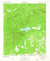
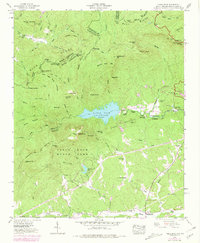
1946 Map of Table Rock
USGS Topo · Published 1965About this map
Table Rock State Park anchors this 1946 landscape, centered on the dramatic granite faces of Table Rock and The Stool. The terrain is defined by the Blue Ridge Divide, where the waters of the East Fork French Broad River and the Middle Saluda River begin their descent toward separate drainage basins. This mid-century survey captures the region just as the Table Rock Reservoir had become a dominant hydrological feature, providing a stable water source for the growing communities to the south.
Find a feature on this map
62 named features on this map. Tap any name to fly to it.
Don’t see what you’re looking for? This feature index may not catch every label — zoom into the map to look around manually.
Map Details
Editions of this 1946 Table Rock Map
5 editions found
Other maps of this area

1888 · Pickens
USGS Topo · 1:125,000

1894 · Pickens
USGS Topo · 1:125,000

1905 · Pisgah
USGS Topo · 1:125,000

1906 · Pisgah
USGS Topo · 1:125,000

1935 · Brevard
USGS Topo · 1:24,000

1935 · Eastatoe Gap
USGS Topo · 1:24,000

1935 · Standingstone Mtn.
USGS Topo · 1:24,000

1935 · Rosman
USGS Topo · 1:24,000

1935 · Table Rock
USGS Topo · 1:24,000
1945 · Brevard
USGS Topo · 1:24,000