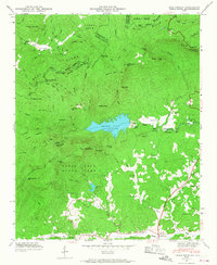
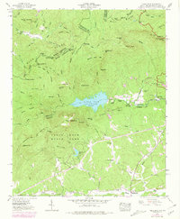
1946 Map of Table Rock
USGS Topo · Published 1968About this map
The Table Rock Reservoir serves as a central anchor for this 1946 survey of the Blue Ridge escarpment along the border of the Carolinas. This rugged terrain is defined by dramatic geologic features, including the massive granite dome of Table Rock and its adjacent formation, The Stool. To the south, Table Rock State Park and Pinnacle Lake offer a glimpse into the early development of the region's recreational landscape. The topography transitions from the high peaks of Pinnacle Mtn and Rocky Mtn down toward the Oolenoy River valley, where small rural outposts like Lakemont and Dowthit are located. Genealogists may find value in the specific locations of several rural schools and burial grounds, such as New Town Sch, Pleasant Grove Sch, and the Cassell Cems. The northern portion is dominated by the steep drainage of Matthews Creek and the Raven Cliff Falls, overseen by the Caesars Head Lookout Tower.
Find a feature on this map
70 named features on this map. Tap any name to fly to it.
Don’t see what you’re looking for? This feature index may not catch every label — zoom into the map to look around manually.
Map Details
Editions of this 1946 Table Rock Map
5 editions found
Other maps of this area

1888 · Pickens
USGS Topo · 1:125,000

1894 · Pickens
USGS Topo · 1:125,000

1905 · Pisgah
USGS Topo · 1:125,000

1906 · Pisgah
USGS Topo · 1:125,000

1935 · Brevard
USGS Topo · 1:24,000

1935 · Eastatoe Gap
USGS Topo · 1:24,000

1935 · Standingstone Mtn.
USGS Topo · 1:24,000

1935 · Rosman
USGS Topo · 1:24,000

1935 · Table Rock
USGS Topo · 1:24,000
1945 · Brevard
USGS Topo · 1:24,000