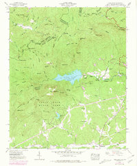
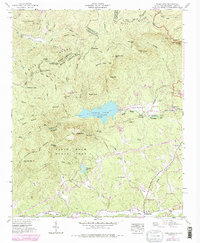
1946 Map of Table Rock
USGS Topo · Published 1979About this map
The Blue Ridge Divide separates the upper reaches of the Saluda River and the Oolenoy River drainage in this detailed look at the South Carolina and North Carolina borderlands. Originally field-checked by the Tennessee Valley Authority in 1946, the landscape is dominated by the massive granite features of Table Rock and The Stool, alongside the prominent Table Rock Reservoir. The map illustrates a rural community anchored by local institutions like New Town Sch, Rock Sch, and Saluda Hill Ch. Significant elevation changes are marked by Pinnacle Mtn and Raven Cliff Falls, while the lower elevations near Pumpkintown show the progression of local roadways including the early stages of the Foothills Scenic Parkway. This survey preserves the locations of generational landmarks like Cassell Cems and the clustered residences at Mountain Lake Colony.
Find a feature on this map
59 named features on this map. Tap any name to fly to it.
Don’t see what you’re looking for? This feature index may not catch every label — zoom into the map to look around manually.
Map Details
Editions of this 1946 Table Rock Map
5 editions found
Other maps of this area

1888 · Pickens
USGS Topo · 1:125,000

1894 · Pickens
USGS Topo · 1:125,000

1905 · Pisgah
USGS Topo · 1:125,000

1906 · Pisgah
USGS Topo · 1:125,000

1935 · Brevard
USGS Topo · 1:24,000

1935 · Eastatoe Gap
USGS Topo · 1:24,000

1935 · Standingstone Mtn.
USGS Topo · 1:24,000

1935 · Rosman
USGS Topo · 1:24,000

1935 · Table Rock
USGS Topo · 1:24,000
1945 · Brevard
USGS Topo · 1:24,000