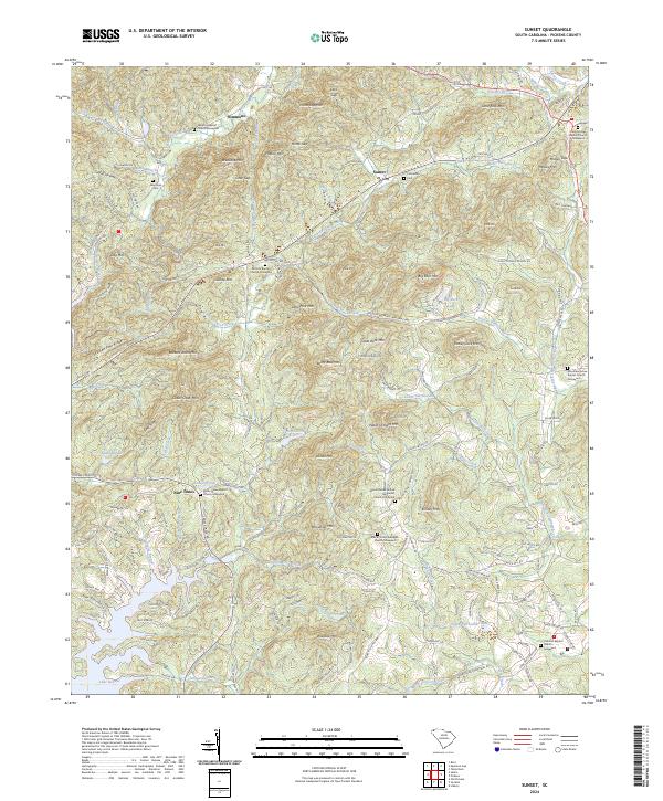
2024 Map of Sunset
USGS Topo · Published 2024About this map
Sunset and Nine Times anchor this portion of Pickens County, where the Blue Ridge foothills transition into a complex network of ridges and river valleys. The landscape is defined by its numerous small community cemeteries and churchyards, such as the Eastatoe Baptist Church Graveyard and Antioch Baptist Church Graveyard, which serve as vital touchstones for local genealogical research. Waterways like the Oolenoy River and Little Eastatoe Creek carve paths through the mountainous terrain, past peaks like Big Rock Mtn and Turkey Cock Mtn.
Find a feature on this map
169 named features on this map. Tap any name to fly to it.
Don’t see what you’re looking for? This feature index may not catch every label — zoom into the map to look around manually.
Map Details
Editions of this 2024 Sunset Map
This is the sole edition of this map. No revisions or reprints were ever made.
Other maps of this area

1888 · Pickens
USGS Topo · 1:125,000

1894 · Pickens
USGS Topo · 1:125,000

1905 · Pisgah
USGS Topo · 1:125,000

1906 · Pisgah
USGS Topo · 1:125,000

1935 · Eastatoe Gap
USGS Topo · 1:24,000

1935 · Reid
USGS Topo · 1:24,000

1935 · Table Rock
USGS Topo · 1:24,000
1946 · Eastatoe Gap
USGS Topo · 1:24,000
1946 · Reid
USGS Topo · 1:24,000
1946 · Table Rock
USGS Topo · 1:24,000