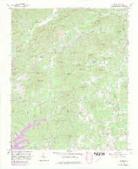
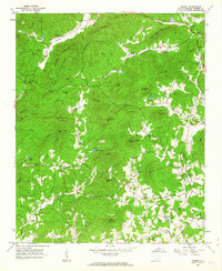
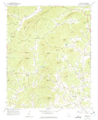
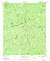
1961 Map of Sunset
USGS Topo · Published 1981About this map
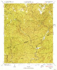
The settlement of Sunset and the surrounding Blue Ridge foothills are documented here as the landscape began to shift with new hydroelectric and recreational development. A significant portion of the western terrain is defined by the rising waters of Lake Keowee, with the newly established Keowee Toxaway State Park appearing along its shores. This transition is superimposed over a much older rural network of family-named ridges and gaps, including Wadakoe Mountain, Mosley Mtn, and Turner Hill.
Find a feature on this map
96 named features on this map. Tap any name to fly to it.
Don’t see what you’re looking for? This feature index may not catch every label — zoom into the map to look around manually.
Map Details
Editions of this 1961 Sunset Map
3 editions found
Other maps of this area

1888 · Pickens
USGS Topo · 1:125,000

1894 · Pickens
USGS Topo · 1:125,000

1905 · Pisgah
USGS Topo · 1:125,000

1906 · Pisgah
USGS Topo · 1:125,000

1935 · Eastatoe Gap
USGS Topo · 1:24,000

1935 · Reid
USGS Topo · 1:24,000

1935 · Table Rock
USGS Topo · 1:24,000
1946 · Eastatoe Gap
USGS Topo · 1:24,000
1946 · Reid
USGS Topo · 1:24,000

1946 · Table Rock
USGS Topo · 1:24,000