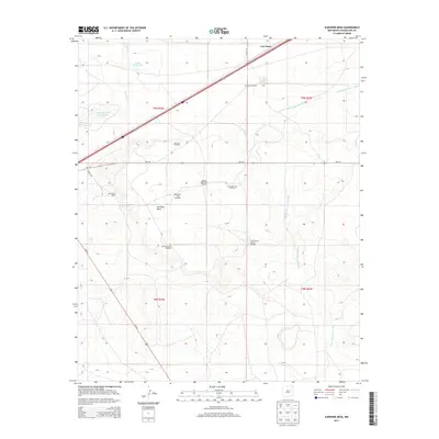
2013 Map of Sunshine Mesa
USGS Topo · Published 2013About this map
Sunshine Mesa rises above the high plains of Guadalupe County, defining a landscape shaped by water management and ranching operations. The small settlement of Los Tanos sits at the northern edge of the map, served by the railroad and nearby Los Tanos Cr. The distribution of features like Moorhouse Ranch and a network of specialized water sources, including the West Buck Trap Windmill and Big Spring Pasture Windmill, illustrates the extensive infrastructure required for livestock in this arid environment. Significant water bodies such as Nine Hundred Acre Lake and the S Los Tanos Tank provide critical focal points for the surrounding terrain. These elements, alongside the winding Arroyo San Juan de Dios, offer a detailed view of the regional geography as it existed in the early 21st century.
Find a feature on this map
22 named features on this map. Tap any name to fly to it.
Don’t see what you’re looking for? This feature index may not catch every label — zoom into the map to look around manually.
Map Details
Editions of this 2013 Sunshine Mesa Map
This is the sole edition of this map. No revisions or reprints were ever made.
Other maps of this area

1892 · Corazon
USGS Topo · 1:125,000

1894 · Corazon
USGS Topo · 1:125,000

1954 · Santa Fe
USGS Topo · 1:250,000

1954 · Fort Sumner
USGS Topo · 1:250,000

1958 · Fort Sumner
USGS Topo · 1:250,000

1958 · Santa Fe
USGS Topo · 1:250,000

1963 · Santa Rosa
USGS Topo · 1:24,000

1963 · Puerto Creek
USGS Topo · 1:24,000

1963 · Sunshine Mesa
USGS Topo · 1:24,000

1963 · Puerto De Luna
USGS Topo · 1:24,000