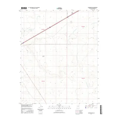
2017 Map of Sunshine Mesa
USGS Topo · Published 2017About this map
Sunshine Mesa dominates the central landscape of this Guadalupe County region, characterized by its prominent elevation above the surrounding desert terrain. The settlement of Los Tanos sits at the northern edge, where modern transportation corridors intersect this historically arid ranching landscape. Water management remains a critical theme of the area, evidenced by features such as S Los Tanos Tank and the uniquely named Nine Hundred Acre Lake. Drainage patterns are defined by the Los Tanos Cr and the winding Arroyo San Juan de Dios, which carve through the high plains. The map reveals a network of rural routes like White Rd and No Se Rd that provide access to remote townships and range lands, illustrating the modern spatial organization of the New Mexico interior.
Find a feature on this map
13 named features on this map. Tap any name to fly to it.
Don’t see what you’re looking for? This feature index may not catch every label — zoom into the map to look around manually.
Map Details
Editions of this 2017 Sunshine Mesa Map
This is the sole edition of this map. No revisions or reprints were ever made.
Other maps of this area

1892 · Corazon
USGS Topo · 1:125,000

1894 · Corazon
USGS Topo · 1:125,000

1954 · Santa Fe
USGS Topo · 1:250,000

1954 · Fort Sumner
USGS Topo · 1:250,000

1958 · Fort Sumner
USGS Topo · 1:250,000

1958 · Santa Fe
USGS Topo · 1:250,000

1963 · Santa Rosa
USGS Topo · 1:24,000

1963 · Puerto Creek
USGS Topo · 1:24,000

1963 · Sunshine Mesa
USGS Topo · 1:24,000

1963 · Puerto De Luna
USGS Topo · 1:24,000