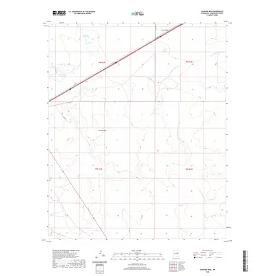
2020 Map of Sunshine Mesa
USGS Topo · Published 2020About this map
Sunshine Mesa dominates this Guadalupe County landscape, rising above a network of drainages and seasonal water sources. The small settlement of Los Tanos sits in the northern portion of the map, situated along a primary transportation corridor that cuts diagonally across the high plains. Water management is a defining feature of this arid region, as evidenced by the namesake Los Tanos Cr and the South Los Tanos Tank. To the west, the curiously named Nine Hundred Acre Lake provides a significant hydrological landmark. The topography is further defined by the winding course of the Arroyo San Juan de Dios, which carves through the eastern sections of the township. Local infrastructure remains sparse, primarily consisting of rural routes like White Rd and Co Rd 1 D that serve the outlying ranch lands.
Find a feature on this map
12 named features on this map. Tap any name to fly to it.
Don’t see what you’re looking for? This feature index may not catch every label — zoom into the map to look around manually.
Map Details
Editions of this 2020 Sunshine Mesa Map
This is the sole edition of this map. No revisions or reprints were ever made.
Other maps of this area

1892 · Corazon
USGS Topo · 1:125,000

1894 · Corazon
USGS Topo · 1:125,000

1954 · Santa Fe
USGS Topo · 1:250,000

1954 · Fort Sumner
USGS Topo · 1:250,000

1958 · Fort Sumner
USGS Topo · 1:250,000

1958 · Santa Fe
USGS Topo · 1:250,000

1963 · Santa Rosa
USGS Topo · 1:24,000

1963 · Puerto Creek
USGS Topo · 1:24,000

1963 · Sunshine Mesa
USGS Topo · 1:24,000

1963 · Puerto De Luna
USGS Topo · 1:24,000