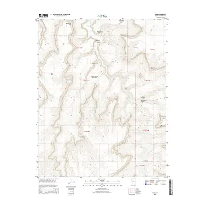
2014 Map of Supai
USGS Topo · Published 2014About this map
Supai is the central focus of this 2014 survey, located at the confluence of several massive drainage systems. The settlement is positioned near the dramatic descent of Havasu Cr, which feeds the famous Fiftyfoot Falls. This landscape is defined by its verticality, with named landmarks like Watahomigie Point and Manakacha Point towering over the canyon floor. The map records the intricate network of canyons, including Hualapai Canyon and Cataract Canyon, which serve as the primary conduits for travel and water in this arid environment. Beyond the residential center, the survey identifies important water sources such as Havasu Springs and Panya Tank, which are vital for life in the deep canyon reaches. The presence of Bia-18 indicates the managed access to these traditional lands, while features like Schoolhouse Canyon and Wigleeva highlight the localized cultural and natural landmarks of the region.
Find a feature on this map
34 named features on this map. Tap any name to fly to it.
Don’t see what you’re looking for? This feature index may not catch every label — zoom into the map to look around manually.
Map Details
Editions of this 2014 Supai Map
This is the sole edition of this map. No revisions or reprints were ever made.
Other maps of this area

1886 · Kaibab
USGS Topo · 1:250,000

1953 · Grand Canyon
USGS Topo · 1:250,000

1957 · Grand Canyon
USGS Topo · 1:250,000

1958 · Grand Canyon
USGS Topo · 1:250,000

1960 · Grand Canyon
USGS Topo · 1:250,000

1962 · Kanab Point
USGS Topo · 1:62,500

1962 · Tuckup Canyon
USGS Topo · 1:62,500

1962 · Supai
USGS Topo · 1:62,500

1962 · National Canyon
USGS Topo · 1:62,500

1984 · Grand Canyon
USGS Topo · 1:100,000