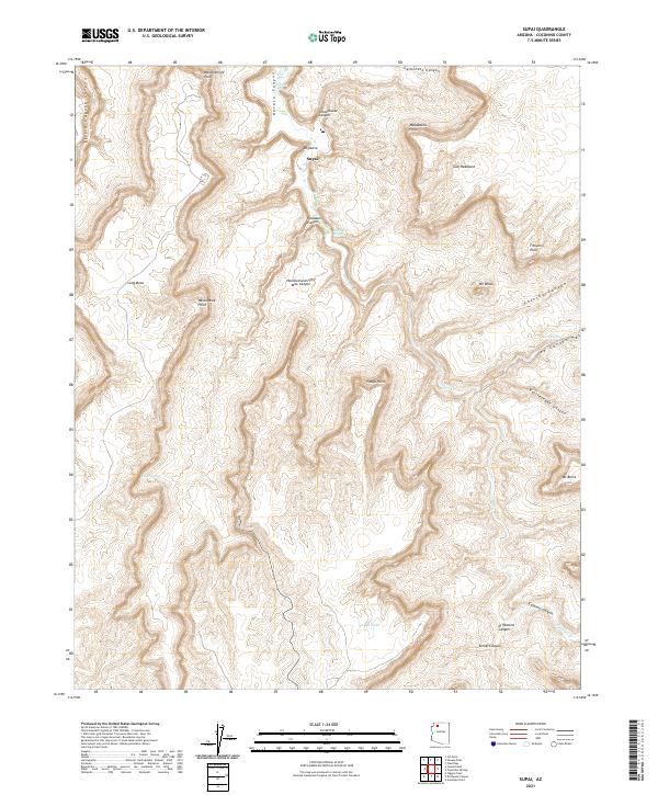
2021 Map of Supai
USGS Topo · Published 2021About this map
Supai sits at the heart of this landscape, positioned within the deep gorge of Havasu Canyon. The area is characterized by a complex network of vertical relief and water sources, where the perennial flow of Cataract Cr descends past Fiftyfoot Falls and Havasu Springs. The map documents a terrain of high plateaus and promontories, including Watahomigie Point and Manakacha Point, which overlook a series of branching drainages such as Hualapai Canyon and Schoolhouse Canyon. The presence of Wigleeva and various tanks like Panya Tank highlights the vital importance of water management and named landmarks in this isolated desert environment. This survey captures the relationship between the local topography and the enduring settlement at Supai, providing a detailed record of the trails and natural features that define the Havasupai homeland in the twenty-first century.
Find a feature on this map
35 named features on this map. Tap any name to fly to it.
Don’t see what you’re looking for? This feature index may not catch every label — zoom into the map to look around manually.
Map Details
Editions of this 2021 Supai Map
This is the sole edition of this map. No revisions or reprints were ever made.
Other maps of this area

1886 · Kaibab
USGS Topo · 1:250,000

1953 · Grand Canyon
USGS Topo · 1:250,000

1957 · Grand Canyon
USGS Topo · 1:250,000

1958 · Grand Canyon
USGS Topo · 1:250,000

1960 · Grand Canyon
USGS Topo · 1:250,000

1962 · Kanab Point
USGS Topo · 1:62,500

1962 · Tuckup Canyon
USGS Topo · 1:62,500

1962 · Supai
USGS Topo · 1:62,500

1962 · National Canyon
USGS Topo · 1:62,500

1984 · Grand Canyon
USGS Topo · 1:100,000