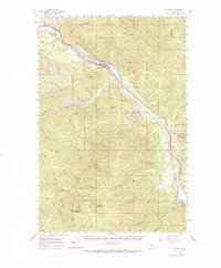
1960 Map of Superior
USGS Topo · Published 1971About this map
Superior serves as the primary settlement in this mountainous corner of western Montana, situated along a prominent bend of the Clark Fork river. The landscape is defined by the steep drainage basins of the Lolo National Forest, where numerous named peaks like Thompson Peak and Sunrise Mountain overlook a complex network of gulches and creeks. The corridor following the river is a vital artery for transportation, showing the parallel routes of two major western railroads: the Northern Pacific and the Chicago Milwaukee St Paul and Pacific. Small riverside communities such as Quartz, Lozeau, and Westfall provide evidence of early 20th-century settlement patterns tied to these rail lines and the timber resources of the surrounding valley. Further south, the Quartz Guard Station and landmarks like Eagle Rock mark the more remote interior of the national forest.
Find a feature on this map
54 named features on this map. Tap any name to fly to it.
Don’t see what you’re looking for? This feature index may not catch every label — zoom into the map to look around manually.
Map Details
Editions of this 1960 Superior Map
2 editions found

Other maps of this area

1911 · Lolo
USGS Topo · 1:250,000

1913 · Lolo
USGS Topo · 1:250,000

1918 · St Regis
USGS Topo · 1:125,000

1919 · St. Regis
USGS Topo · 1:125,000

1956 · St Regis
USGS Topo · 1:62,500

1956 · Wallace
USGS Topo · 1:250,000

1956 · Hamilton
USGS Topo · 1:250,000

1957 · Illinois Peak
USGS Topo · 1:62,500

1959 · Hamilton
USGS Topo · 1:250,000

1959 · Tarkio
USGS Topo · 1:62,500