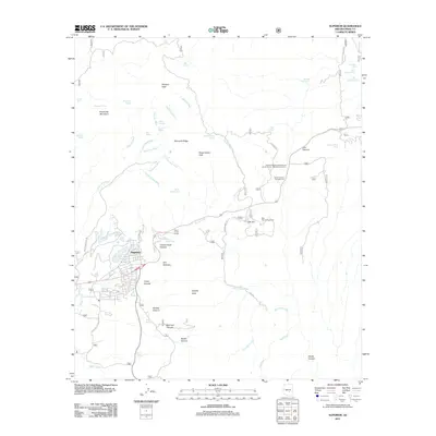
2011 Map of Superior
USGS Topo · Published 2011About this map
Superior serves as the focal point of this Copper Country landscape, where the town site is bounded by the dramatic escarpment of Apache Leap and the deep drainage of Queen Creek. The map documents the complex relationship between mining infrastructure and the natural terrain, notably along Silver King Mine Rd and Magma Mine Rd. Beyond the town, the high desert landscape is defined by a network of seasonal washes and canyons, including Devils Canyon and Elm Canyon. Local recreation and infrastructure are well-marked, featuring the Oak Flat Campground and the Arizona Highway Department Devils Canyon Maintenance Camp. Water management in this arid environment is highlighted by numerous tanks and springs, such as the Superior Water Tank and Fortuna Wash, illustrating how the region's industry and settlements have historically adapted to the drainage patterns of the Pinal Mountains.
Find a feature on this map
57 named features on this map. Tap any name to fly to it.
Don’t see what you’re looking for? This feature index may not catch every label — zoom into the map to look around manually.
Map Details
Editions of this 2011 Superior Map
This is the sole edition of this map. No revisions or reprints were ever made.
Other maps of this area

1900 · Florence
USGS Topo · 1:125,000

1901 · Globe
USGS Topo · 1:62,500

1902 · Globe
USGS Topo · 1:62,500

1902 · Florence
USGS Topo · 1:125,000

1910 · Ray
USGS Topo · 1:62,500

1945 · Inspiration
USGS Topo · 1:24,000

1947 · Inspiration
USGS Topo · 1:24,000

1948 · Pinal Ranch
USGS Topo · 1:24,000

1948 · Superior
USGS Topo · 1:62,500

1948 · Superior
USGS Topo · 1:24,000