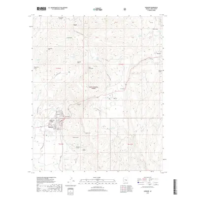
2018 Map of Superior
USGS Topo · Published 2018About this map
Superior sits at the base of the dramatic Apache Leap escarpment, where the high desert terrain meets the complex geology of the Tonto National Forest. This 2018 survey documents a landscape defined by its mining heritage and transit infrastructure, including the Queen Creek Tunnel and roads such as Silver King Mine Rd and Magma Mine Rd that trace the historical routes of Pinal County extraction. The map details the transition from the concentrated grid of the Superior townsite, with streets like N Magma Ave and S Church Ave, to the surrounding wilderness of Queen Creek Canyon and Iron Canyon. Within the forest, scattered water sources such as Pump Station Spring and Bitter Spring punctuate the arid ridges of Silverado Ridge and peaks like Peachville Mtn, indicating the vital importance of water management in this high-elevation Arizona environment.
Find a feature on this map
62 named features on this map. Tap any name to fly to it.
Don’t see what you’re looking for? This feature index may not catch every label — zoom into the map to look around manually.
Map Details
Editions of this 2018 Superior Map
This is the sole edition of this map. No revisions or reprints were ever made.
Other maps of this area

1900 · Florence
USGS Topo · 1:125,000

1901 · Globe
USGS Topo · 1:62,500

1902 · Globe
USGS Topo · 1:62,500

1902 · Florence
USGS Topo · 1:125,000

1910 · Ray
USGS Topo · 1:62,500

1945 · Inspiration
USGS Topo · 1:24,000

1947 · Inspiration
USGS Topo · 1:24,000

1948 · Pinal Ranch
USGS Topo · 1:24,000

1948 · Superior
USGS Topo · 1:62,500

1948 · Superior
USGS Topo · 1:24,000