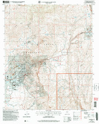
2004 Map of Superior
USGS Topo · Published 2007About this map
The copper and silver mining legacy of the Pinal Mountains is etched across this landscape, centered on the town of Superior. The map details an intensive industrial environment where the Magma No 9 Mine and Belmont Mine operate alongside extensive infrastructure, including a Tailings Pond, large Mine Dump areas, and an Open Pit Mine. To the north, the historic Silver King Mine sits near Peachville, connected to the broader region by the Silver King Substation.
Find a feature on this map
46 named features on this map. Tap any name to fly to it.
Don’t see what you’re looking for? This feature index may not catch every label — zoom into the map to look around manually.
Map Details
Editions of this 2004 Superior Map
This is the sole edition of this map. No revisions or reprints were ever made.
Other maps of this area

1900 · Florence
USGS Topo · 1:125,000

1901 · Globe
USGS Topo · 1:62,500

1902 · Globe
USGS Topo · 1:62,500

1902 · Florence
USGS Topo · 1:125,000

1910 · Ray
USGS Topo · 1:62,500

1945 · Inspiration
USGS Topo · 1:24,000

1947 · Inspiration
USGS Topo · 1:24,000

1948 · Pinal Ranch
USGS Topo · 1:24,000

1948 · Superior
USGS Topo · 1:62,500

1948 · Superior
USGS Topo · 1:24,000