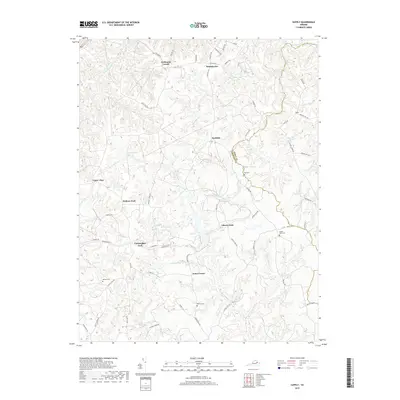
2019 Map of Supply
USGS Topo · Published 2019About this map
Upper Zion and Hickory Fork anchor the western portion of this rural landscape where the headwaters of Beverly Run and Smoots Run drain toward the Rappahannock basin. The terrain is defined by a dense network of intermittent streams and marshlands, including Mason Swamp and Black Water Swamp, which have historically dictated the placement of settlements and roads. Small crossroads and family-named locales like Goldmans Corner, Jones Corner, and Naulakla are connected by narrow routes such as Beverly Town Rd and Hustle Rd. Scattered family cemeteries, including Kay Cem and Rollins Cem, provide localized genealogical markers across the transition from Caroline to Essex County. The map reveals a deeply wooded interior where forestry and small-scale agriculture remain the primary land uses, evidenced by the numerous named forks and clearings.
Find a feature on this map
63 named features on this map. Tap any name to fly to it.
Don’t see what you’re looking for? This feature index may not catch every label — zoom into the map to look around manually.
Map Details
Editions of this 2019 Supply Map
This is the sole edition of this map. No revisions or reprints were ever made.
Other maps of this area

1889 · Fredericksburg
USGS Topo · 1:125,000

1892 · Fredericksburg
USGS Topo · 1:125,000

1894 · Fredericksburg
USGS Topo · 1:125,000

1918 · Doswell
USGS Topo · 1:62,500

1918 · Aylett
USGS Topo · 1:62,500

1933 · Aylett
USGS Topo · 1:62,500

1942 · Bowling Green
USGS Topo · 1:31,680

1942 · Upper Zion
USGS Topo · 1:31,680

1942 · Occupacia
USGS Topo · 1:31,680

1942 · Rollins Fork
USGS Topo · 1:31,680