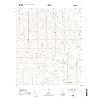
2018 Map of Surginer
USGS Topo · Published 2018About this map
Surginer and the surrounding timberlands of eastern Marengo County are defined by a complex network of creeks and small family cemeteries that trace the region's rural genealogy. The landscape is carved by watercourses such as Pritchett Mill Cr, Baptizing Cr, and Cypress Cr, which feed into the larger Turkey Cr system. Small settlements like Vineland and Hampden anchor the eastern edge of the map near the Marengo and Wilcox County line. The distribution of sites like Arbor Cem, Hosea Cem, and Living Cem suggests a long history of localized family homesteads and church congregations. To the north, Christian Hope Ch and Laurel Presbyterian Cem stand as landmarks of community endurance in this wooded interior of Alabama, where state roads like AL Highway 10 connect these isolated pockets of settlement.
Find a feature on this map
73 named features on this map. Tap any name to fly to it.
Don’t see what you’re looking for? This feature index may not catch every label — zoom into the map to look around manually.
Map Details
Editions of this 2018 Surginer Map
This is the sole edition of this map. No revisions or reprints were ever made.
Other maps of this area

1953 · Montgomery
USGS Topo · 1:250,000

1953 · Andalusia
USGS Topo · 1:250,000

1956 · Montgomery
USGS Topo · 1:250,000

1957 · Montgomery
USGS Topo · 1:250,000

1957 · Andalusia
USGS Topo · 1:250,000

1973 · Pine Hill
USGS Topo · 1:24,000

1973 · Thomasville
USGS Topo · 1:24,000

1978 · Surginer
USGS Topo · 1:24,000

1978 · Sweet Water
USGS Topo · 1:24,000
1978 · Bashi
USGS Topo · 1:24,000