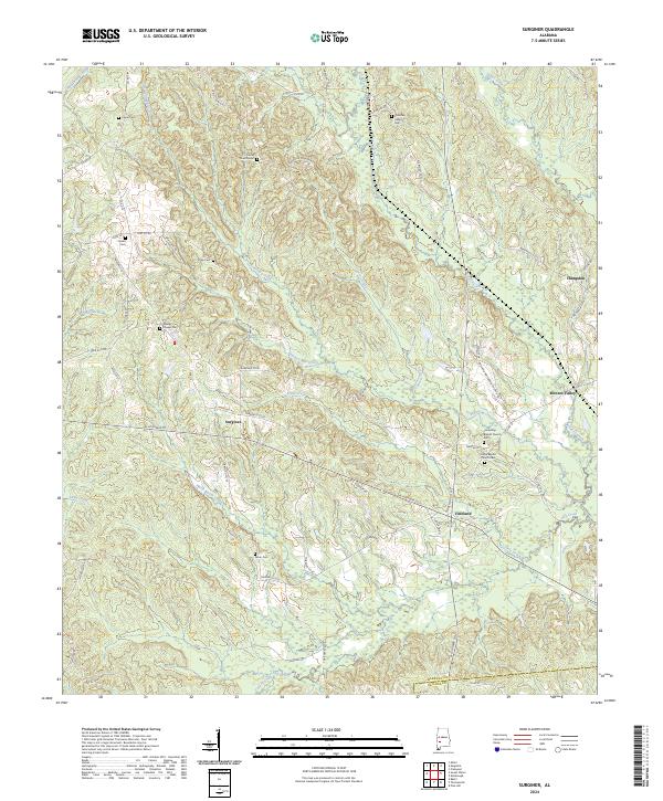
2024 Map of Surginer
USGS Topo · Published 2024About this map
The unincorporated community of Surginer lies at the crossroads of several regional routes, including AL Highway 10 and Marengo Co 32, in a landscape defined by deeply incised drainage systems. Small rural settlements like Vineland, Hampden, and Moores Valley anchor the eastern half of the map, while the western portion is dominated by the winding courses of Pritchett Mill Creek and Threadgill Mill Creek. The area's social history is recorded through numerous small cemeteries often associated with local congregations, including Wesley Chapel Cem, Union Baptist Church Cem, and the Christian Hope Cem. The presence of labels like Living Church Rd and Magnolia Church Rd suggests the historical importance of church-centered communities in this corner of the county. Large creek systems like Cypress Creek and Turkey Creek flow south toward the Wilcox County line, illustrating the drainage patterns that shaped local land use and property boundaries.
Find a feature on this map
66 named features on this map. Tap any name to fly to it.
Don’t see what you’re looking for? This feature index may not catch every label — zoom into the map to look around manually.
Map Details
Editions of this 2024 Surginer Map
This is the sole edition of this map. No revisions or reprints were ever made.
Other maps of this area

1953 · Montgomery
USGS Topo · 1:250,000

1953 · Andalusia
USGS Topo · 1:250,000

1956 · Montgomery
USGS Topo · 1:250,000

1957 · Montgomery
USGS Topo · 1:250,000

1957 · Andalusia
USGS Topo · 1:250,000

1973 · Pine Hill
USGS Topo · 1:24,000

1973 · Thomasville
USGS Topo · 1:24,000

1978 · Surginer
USGS Topo · 1:24,000

1978 · Sweet Water
USGS Topo · 1:24,000
1978 · Bashi
USGS Topo · 1:24,000