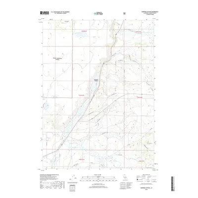
2018 Map of Surprise Station
USGS Topo · Published 2018About this map
N Fork Pit River flows through the heart of this Modoc County landscape, shaping a valley floor that supports a network of ranching roads and remote outposts. The settlement of Surprise Station sits centrally as a waypoint in this high-desert terrain, where the Modoc National Forest boundary meets private holdings. Traces of the region's overland history are evident in the Old Imigrant Trl, which skirts the western edge of the quadrangle near the Griener Reservoir. The hydrology of the area is further defined by seasonal drainages and springs, such as Leonard Spring and Gleason Cr, which are essential to the local ecosystem. From the heights of Round Mtn to the southern waters of Porter Reservoir, the map illustrates a landscape of managed forests and traditional cattle ranching operations common to the far northern reaches of California.
Find a feature on this map
39 named features on this map. Tap any name to fly to it.
Don’t see what you’re looking for? This feature index may not catch every label — zoom into the map to look around manually.
Map Details
Editions of this 2018 Surprise Station Map
This is the sole edition of this map. No revisions or reprints were ever made.
Other maps of this area

1886 · Alturas
USGS Topo · 1:250,000

1892 · Alturas
USGS Topo · 1:250,000

1954 · Alturas
USGS Topo · 1:250,000

1958 · Alturas
USGS Topo · 1:250,000

1961 · Alturas
USGS Topo · 1:62,500

1962 · Alturas
USGS Topo · 1:250,000

1962 · Davis Creek
USGS Topo · 1:62,500

1962 · Big Sage Reservoir
USGS Topo · 1:62,500

1963 · Shields Creek
USGS Topo · 1:24,000

1963 · Dorris Reservoir
USGS Topo · 1:24,000