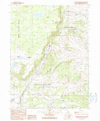
1990 Map of Surprise Station
USGS Topo · Published 1990About this map
The X L Ranch Indian Reservation and the Modoc National Forest define the high-country landscape of this Modoc County territory as it appeared in 1990. The North Fork Pit River carves a significant corridor through the center of the sheet, joined by tributaries like Joseph Creek and Thoms Creek. This area is marked by its specialized land use, including the Alturas Agr Insp Sta and the Chimney Rock Historical Mon, reflecting both the agricultural management and the cultural history of the region.
Find a feature on this map
22 named features on this map. Tap any name to fly to it.
Don’t see what you’re looking for? This feature index may not catch every label — zoom into the map to look around manually.
Map Details
Editions of this 1990 Surprise Station Map
This is the sole edition of this map. No revisions or reprints were ever made.
Other maps of this area

1886 · Alturas
USGS Topo · 1:250,000

1892 · Alturas
USGS Topo · 1:250,000

1954 · Alturas
USGS Topo · 1:250,000

1958 · Alturas
USGS Topo · 1:250,000

1961 · Alturas
USGS Topo · 1:62,500

1962 · Alturas
USGS Topo · 1:250,000

1962 · Davis Creek
USGS Topo · 1:62,500

1962 · Big Sage Reservoir
USGS Topo · 1:62,500

1963 · Shields Creek
USGS Topo · 1:24,000

1963 · Dorris Reservoir
USGS Topo · 1:24,000