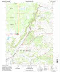
1993 Map of Surprise Station
USGS Topo · Published 1995About this map
The XL Ranch Indian Reservation dominates the eastern half of this landscape, where the North Fork Pit River carves a path through the high desert of Modoc County. In the early 1990s, the area's agricultural and transit infrastructure is clearly visible, from the Alturas Agr Insp Sta and Surprise Station to the complex water management system of the Diversion Dam and Flume. Significant local landmarks include the Chimney Rock Historical Mon and high-altitude water sources like Mud Lake Reservoir and Griener Reservoir. The map illustrates a region defined by ranching and resource management, with remote outposts like Joseph Creek Ranch and various Gravel Pits scattered near the Modoc National Forest boundary.
Find a feature on this map
24 named features on this map. Tap any name to fly to it.
Don’t see what you’re looking for? This feature index may not catch every label — zoom into the map to look around manually.
Map Details
Editions of this 1993 Surprise Station Map
This is the sole edition of this map. No revisions or reprints were ever made.
Other maps of this area

1886 · Alturas
USGS Topo · 1:250,000

1892 · Alturas
USGS Topo · 1:250,000

1954 · Alturas
USGS Topo · 1:250,000

1958 · Alturas
USGS Topo · 1:250,000

1961 · Alturas
USGS Topo · 1:62,500

1962 · Alturas
USGS Topo · 1:250,000

1962 · Davis Creek
USGS Topo · 1:62,500

1962 · Big Sage Reservoir
USGS Topo · 1:62,500

1963 · Shields Creek
USGS Topo · 1:24,000

1963 · Dorris Reservoir
USGS Topo · 1:24,000