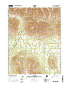
2016 Map of Survey Pass A-2 SW
USGS Topo · Published 2016About this map
Gates of the Arctic National Park and the Gates of the Arctic National Preserve meet in this northern Alaskan landscape, where the administrative boundary divides a wilderness of subarctic lowlands and sharp elevations. The area is defined by the historic Alatna Portage, a significant overland route through the wetlands and brush. The drainage of the Vichayakaka Cr winds through the northwestern corner of the quadrangle, while the Helpmejack Hills rise to the south. These hills overlook the basin of Helpmejack Cr, illustrating the complex hydrology of the Koyukuk River region. The map captures a section of the Brooks Range foothills where the transition from river valleys to upland terrain remains largely untouched by modern development.
Find a feature on this map
10 named features on this map. Tap any name to fly to it.
Don’t see what you’re looking for? This feature index may not catch every label — zoom into the map to look around manually.
Map Details
Editions of this 2016 Survey Pass A-2 SW Map
This is the sole edition of this map. No revisions or reprints were ever made.
Other maps of this area

1951 · Hughes
USGS Topo · 1:250,000

1951 · Survey Pass
USGS Topo · 1:250,000

1956 · Hughes
USGS Topo · 1:250,000

1956 · Survey Pass
USGS Topo · 1:250,000

1964 · Survey Pass
USGS Topo · 1:250,000

1964 · Hughes
USGS Topo · 1:250,000

1965 · Hughes
USGS Topo · 1:250,000

1966 · Survey Pass
USGS Topo · 1:250,000
1986 · Survey Pass A-3
USGS Topo · 1:63,360
1986 · Hughes D-3
USGS Topo · 1:63,360