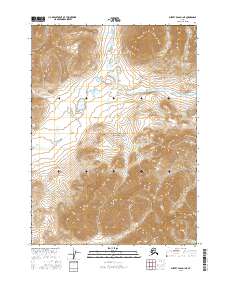
2016 Map of Survey Pass D-1 NE
USGS Topo · Published 2016About this map
Gates of the Arctic National Park encompasses the majority of this high-elevation Alaskan terrain, where the Brooks Range landscape is defined by extreme relief and glacial drainage patterns. Water systems including Agiak Creek and Easter Creek carve through the northern sections, while Koyuk Creek drains the southern slopes. A notable landmark in the central northern area is Lonely Lake, a isolated body of water positioned within a high mountain basin. The map reveals the intricate topography of the Central Brooks Range, documenting a wilderness area devoid of roads or permanent settlements. Detailed contouring illustrates the complex network of ridges and valleys that dictate the flow of Arctic-bound and interior-bound waterways during the mid-2010s.
Find a feature on this map
9 named features on this map. Tap any name to fly to it.
Don’t see what you’re looking for? This feature index may not catch every label — zoom into the map to look around manually.
Map Details
Editions of this 2016 Survey Pass D-1 NE Map
This is the sole edition of this map. No revisions or reprints were ever made.
Other maps of this area

1951 · Survey Pass
USGS Topo · 1:250,000

1951 · Chandler Lake
USGS Topo · 1:250,000

1951 · Killik River
USGS Topo · 1:250,000

1951 · Wiseman
USGS Topo · 1:250,000

1956 · Wiseman
USGS Topo · 1:250,000

1956 · Survey Pass
USGS Topo · 1:250,000

1956 · Chandler Lake
USGS Topo · 1:250,000

1956 · Killik River
USGS Topo · 1:250,000

1964 · Survey Pass
USGS Topo · 1:250,000

1964 · Wiseman
USGS Topo · 1:250,000