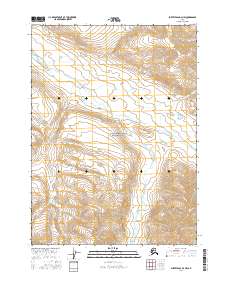
2016 Map of Survey Pass D-3 NW
USGS Topo · Published 2016About this map
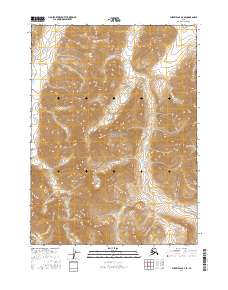
Gates Of The Arctic National Park encompasses a significant portion of this landscape, where the high-altitude terrain is defined by the headwaters of several drainages. The northern sections are primarily oriented around the flow of April Creek, which trends toward the northwest through a series of steep topographic contours. To the south and east, the drainage pattern shifts toward Doc Cr, illustrating the complex hydrology of this interior Alaskan wilderness. This 2016 survey provides a precise view of the land as managed under federal conservation, showing the township and range divisions of t30n r19e, t30n r20e, t29n r19e, and t29n r20e that overlie the natural topography. The map serves as a vital record for understanding the modern boundary intersections and environmental characteristics of this protected region.
Find a feature on this map
8 named features on this map. Tap any name to fly to it.
Don’t see what you’re looking for? This feature index may not catch every label — zoom into the map to look around manually.
Map Details
Editions of this 2016 Survey Pass D-3 NW Map
This is the sole edition of this map. No revisions or reprints were ever made.
Other maps of this area

1951 · Survey Pass
USGS Topo · 1:250,000

1951 · Killik River
USGS Topo · 1:250,000

1956 · Survey Pass
USGS Topo · 1:250,000

1956 · Killik River
USGS Topo · 1:250,000

1964 · Survey Pass
USGS Topo · 1:250,000

1966 · Survey Pass
USGS Topo · 1:250,000
1986 · Killik River A-3
USGS Topo · 1:63,360
1986 · Survey Pass D-4
USGS Topo · 1:63,360
1986 · Survey Pass D-3
USGS Topo · 1:63,360
2016 · Survey Pass D-3 SE
USGS Topo · 1:25,000