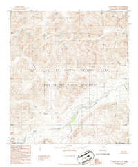
1986 Map of Killik River A-3
USGS Topo · Published 1986About this map
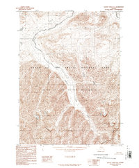
Gates Of The Arctic National Park and the surrounding wilderness are defined by a complex drainage network in this 1980s topographic record. The Killik River serves as the central artery for the region, fed by numerous named tributaries including April Creek, Mary Creek, and Ayakalak Creek. This map, based on aerial photography from 1973, provides a detailed view of the North Slope Borough's undeveloped interior before more modern mapping efforts. The land is characterized by steep elevation changes and high ridges that separate the various watersheds. Smaller waterways like Enekalikruak Creek and Sugakuik Creek carve through the northern terrain, while Kakiutak Creek and Sinuk Creek mark the southern reaches of this remote Alaskan quadrangle. The lack of roads or established settlements emphasizes the pristine character of the Gates Of The Arctic Wilderness at the time of this publication.
Find a feature on this map
13 named features on this map. Tap any name to fly to it.
Don’t see what you’re looking for? This feature index may not catch every label — zoom into the map to look around manually.
Map Details
Editions of this 1986 Killik River A-3 Map
This is the sole edition of this map. No revisions or reprints were ever made.
Other maps of this area

1951 · Survey Pass
USGS Topo · 1:250,000

1951 · Killik River
USGS Topo · 1:250,000

1956 · Survey Pass
USGS Topo · 1:250,000

1956 · Killik River
USGS Topo · 1:250,000

1964 · Survey Pass
USGS Topo · 1:250,000

1966 · Survey Pass
USGS Topo · 1:250,000
1986 · Killik River A-2
USGS Topo · 1:63,360
1986 · Killik River B-2
USGS Topo · 1:63,360
1986 · Killik River A-4
USGS Topo · 1:63,360
1986 · Survey Pass D-4
USGS Topo · 1:63,360