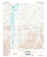
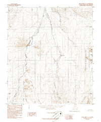
1986 Map of Killik River B-2
USGS Topo · Published 1986About this map
Gates of the Arctic National Park encompasses the southern half of this interior North Slope terrain, where the Killik River flows northward through a complex network of braided channels and expansive river bars. This 1986 edition reflects a period after the establishment of the Gates of the Arctic Wilderness, documenting a landscape defined by water and elevation rather than human infrastructure. The map records the intersection of the Umiat and Kateel River Meridians, a significant surveying boundary that bisects the central portion of the sheet near Kaikshak Hill. North of the park boundary, the river valley widens to include prominent water bodies like Imiaknikpak Lake and Lake Udriuik. Tributaries such as Silalinigun Creek and Akmalik Creek drain the surrounding highlands, illustrating the hydrological patterns of the Brooks Range foothills before they reach the northern coastal plain.
Find a feature on this map
13 named features on this map. Tap any name to fly to it.
Don’t see what you’re looking for? This feature index may not catch every label — zoom into the map to look around manually.
Map Details
Editions of this 1986 Killik River B-2 Map
This is the sole edition of this map. No revisions or reprints were ever made.
Other maps of this area

1951 · Killik River
USGS Topo · 1:250,000

1956 · Killik River
USGS Topo · 1:250,000
1986 · Killik River A-2
USGS Topo · 1:63,360
1986 · Killik River C-2
USGS Topo · 1:63,360
1986 · Killik River A-1
USGS Topo · 1:63,360
1986 · Killik River C-3
USGS Topo · 1:63,360
1986 · Killik River A-3
USGS Topo · 1:63,360
1986 · Killik River B-1
USGS Topo · 1:63,360
1986 · Killik River B-3
USGS Topo · 1:63,360
1986 · Killik River C-1
USGS Topo · 1:63,360