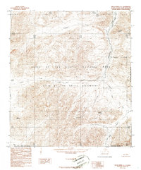
1986 Map of Killik River A-1
USGS Topo · Published 1986About this map
The Continental Divide traverses this high-latitude terrain within the North Slope Borough, defining the drainage patterns of the Central Brooks Range. This 1980s topographic survey captures a landscape of intense relief where the Okokmilaga River and Kugukpak Creek carve through the northern slopes. The map covers a significant portion of the Gates of the Arctic National Park and the protected Gates of the Arctic Wilderness, documenting the area before modern digital mapping. Notable summits like Marker Mountain, Grizzly Mountain, and Papik Mountain serve as primary landmarks in this roadless region, where numerous tributaries including Iklauyak Creek, Sulugiak Creek, and Suluak Creek flow from the divide toward the Arctic coast. The absence of any human-made infrastructure or settlements underscores the protected status and character of this wilderness area at the time of the survey.
Find a feature on this map
14 named features on this map. Tap any name to fly to it.
Don’t see what you’re looking for? This feature index may not catch every label — zoom into the map to look around manually.
Map Details
Editions of this 1986 Killik River A-1 Map
This is the sole edition of this map. No revisions or reprints were ever made.
Other maps of this area

1951 · Survey Pass
USGS Topo · 1:250,000

1951 · Chandler Lake
USGS Topo · 1:250,000

1951 · Killik River
USGS Topo · 1:250,000

1951 · Wiseman
USGS Topo · 1:250,000

1956 · Wiseman
USGS Topo · 1:250,000

1956 · Survey Pass
USGS Topo · 1:250,000

1956 · Chandler Lake
USGS Topo · 1:250,000

1956 · Killik River
USGS Topo · 1:250,000

1964 · Survey Pass
USGS Topo · 1:250,000

1964 · Wiseman
USGS Topo · 1:250,000