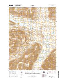
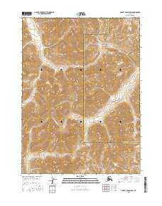
2016 Map of Survey Pass D-5 NE
USGS Topo · Published 2016About this map
The Continental Divide defines the hydrologic character of this remote Alaskan interior landscape, where the waters of the Nigu River flow northward while the Alatna River drains to the south. This 2016 survey documents the high-altitude headwaters within Gates of the Arctic National Park, a vast wilderness designated for its ecological and scientific value. The map illustrates a landscape shaped by glacial action, showing the intricate contour intervals of the surrounding peaks and the braided paths of these primary river systems as they move through the Brooks Range. The absence of roads or established settlements emphasizes the character of this protected wilderness area, serving as a baseline for the geographic features and water systems at the heart of the park.
Find a feature on this map
7 named features on this map. Tap any name to fly to it.
Don’t see what you’re looking for? This feature index may not catch every label — zoom into the map to look around manually.
Map Details
Editions of this 2016 Survey Pass D-5 NE Map
This is the sole edition of this map. No revisions or reprints were ever made.
Other maps of this area

1951 · Survey Pass
USGS Topo · 1:250,000

1951 · Killik River
USGS Topo · 1:250,000

1956 · Survey Pass
USGS Topo · 1:250,000

1956 · Killik River
USGS Topo · 1:250,000

1964 · Survey Pass
USGS Topo · 1:250,000

1966 · Survey Pass
USGS Topo · 1:250,000
1986 · Killik River A-4
USGS Topo · 1:63,360
1986 · Survey Pass D-5
USGS Topo · 1:63,360
1986 · Survey Pass D-4
USGS Topo · 1:63,360
2016 · Survey Pass D-5 SW
USGS Topo · 1:25,000