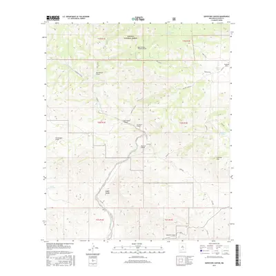
2017 Map of Surveyors Canyon
USGS Topo · Published 2017About this map
Lincoln National Forest dominates this section of the Sacramento Mountains, where complex drainage systems like Surveyors Canyon and Wayland Canyon carve through the high-elevation terrain. The map captures a high-desert landscape defined by vital water management, featuring several catchment basins such as Ben Williams Tank, Kimmons Tank, and Stevens Lake. These isolated water sources were essential for sustaining life and livestock in the arid Otero County interior.
Find a feature on this map
33 named features on this map. Tap any name to fly to it.
Don’t see what you’re looking for? This feature index may not catch every label — zoom into the map to look around manually.
Map Details
Editions of this 2017 Surveyors Canyon Map
This is the sole edition of this map. No revisions or reprints were ever made.
Other maps of this area

1954 · Carlsbad
USGS Topo · 1:250,000

1958 · Carlsbad
USGS Topo · 1:250,000

1963 · Indian Draw
USGS Topo · 1:24,000

1965 · Bear Spring
USGS Topo · 1:24,000

1965 · Surveyors Canyon
USGS Topo · 1:24,000

1965 · Avis
USGS Topo · 1:24,000

1965 · Rogers Ruins
USGS Topo · 1:24,000

1965 · El Paso Canyon
USGS Topo · 1:24,000

1965 · Pinon
USGS Topo · 1:24,000

1979 · Alamogordo
USGS Topo · 1:100,000