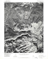
1975 Map of Susanville NW
USGS Topo · Published 1980About this map
Susanville occupies the eastern edge of this orthophoto study, where the developed streets and residential blocks of the town meet the complex terrain of the Sierra Nevada transition. The visual data captured in 1975 provides a rare look at the urban footprint and surrounding geography without the abstraction of traditional topographic contours. Flowing through the center of the image, the Susan River carves a distinct path from the west, joined by Piute Creek as it enters the valley floor. The contrast between the dense vegetation of the uplands and the agricultural and municipal patterns of the settlement illustrates the geographic constraints on the town's expansion during the mid-1970s. For those researching land use or local genealogy, the map offers a clear view of specific property layouts and road networks that defined the community at this time.
Find a feature on this map
3 named features on this map. Tap any name to fly to it.
Don’t see what you’re looking for? This feature index may not catch every label — zoom into the map to look around manually.
Map Details
Editions of this 1975 Susanville NW Map
This is the sole edition of this map. No revisions or reprints were ever made.
Other maps of this area

1886 · Honey Lake
USGS Topo · 1:250,000

1891 · Honey Lake
USGS Topo · 1:250,000

1893 · Honey Lake
USGS Topo · 1:250,000

1954 · Susanville
USGS Topo · 1:62,500

1954 · Litchfield
USGS Topo · 1:62,500

1954 · Karlo
USGS Topo · 1:62,500

1954 · Fredonyer Peak
USGS Topo · 1:62,500

1955 · Westwood
USGS Topo · 1:250,000

1958 · Westwood
USGS Topo · 1:250,000

1959 · Westwood
USGS Topo · 1:250,000