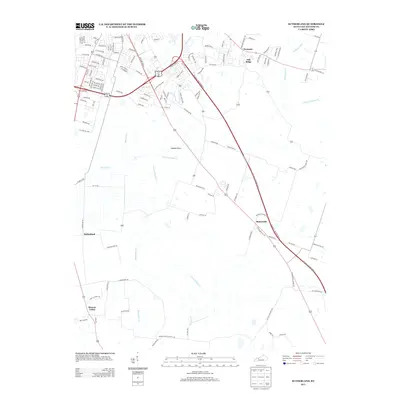
2013 Map of Sutherland
USGS Topo · Published 2013About this map
Masonville and Sutherland anchor this agricultural and suburban landscape south of Owensboro, where the drainage of the Panther Cr system defines the topography. The map illustrates a transition from the dense street grids near Dermont and Oak Ridge to the broader agricultural expanse of Jackson Flats. Extensive water systems, including the N Fork Panther Cr and S Fork Panther Cr, are joined by smaller tributaries like Shoemaker Br and Twomile Cr that cut through the low-lying terrain. To the southwest, Browns Valley sits near the edge of the survey, connected by a network of rural roads that mirror the paths of the local creeks. The alignment of modern thoroughfares through these traditional farming communities provides a clear view of how development has followed the natural breaks in the Daviess County landscape.
Find a feature on this map
125 named features on this map. Tap any name to fly to it.
Don’t see what you’re looking for? This feature index may not catch every label — zoom into the map to look around manually.
Map Details
Editions of this 2013 Sutherland Map
This is the sole edition of this map. No revisions or reprints were ever made.
Other maps of this area

1901 · Owensboro
USGS Topo · 1:62,500

1903 · Tell City
USGS Topo · 1:62,500

1906 · Sutherland
USGS Topo · 1:62,500

1907 · Whitesville
USGS Topo · 1:62,500

1909 · Whitesville
USGS Topo · 1:62,500

1952 · Owensboro East
USGS Topo · 1:24,000

1952 · Owensboro West
USGS Topo · 1:24,000

1953 · Philpot
USGS Topo · 1:24,000

1953 · Sutherland
USGS Topo · 1:24,000

1953 · Utica
USGS Topo · 1:24,000