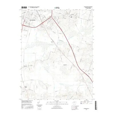
2016 Map of Sutherland
USGS Topo · Published 2016About this map
Owensboro's southeastern residential and collegiate expansion defines the northern edge of this landscape, anchored by the Kentucky Wesleyan Coll campus and Rose Hill Cem. Moving south from the city, the terrain transitions into a intricate drainage network dominated by the Panther Cr and its many branches, including the S Fork Panther Cr and N Fork Panther Cr. These waterways historically dictated the location of rural clusters and agricultural crossings. Scattered communities like Masonville, Sutherland, and Browns Valley are connected by a web of named local routes like Old Hartford Rd and Sutherland Rd. The map documents a blend of mid-century suburban growth alongside enduring family-named cemeteries such as Hix Cem and Holy Cross Cem, providing a clear view of how Daviess County's landscape has evolved from its agricultural roots.
Find a feature on this map
102 named features on this map. Tap any name to fly to it.
Don’t see what you’re looking for? This feature index may not catch every label — zoom into the map to look around manually.
Map Details
Editions of this 2016 Sutherland Map
This is the sole edition of this map. No revisions or reprints were ever made.
Other maps of this area

1901 · Owensboro
USGS Topo · 1:62,500

1903 · Tell City
USGS Topo · 1:62,500

1906 · Sutherland
USGS Topo · 1:62,500

1907 · Whitesville
USGS Topo · 1:62,500

1909 · Whitesville
USGS Topo · 1:62,500

1952 · Owensboro East
USGS Topo · 1:24,000

1952 · Owensboro West
USGS Topo · 1:24,000

1953 · Philpot
USGS Topo · 1:24,000

1953 · Sutherland
USGS Topo · 1:24,000

1953 · Utica
USGS Topo · 1:24,000