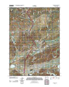
2011 Map of Sutherlin
USGS Topo · Published 2011About this map
Sutherlin and the neighboring city of Oakland serve as the primary hubs in this Douglas County landscape, where the flat valley floor of Camas Swale meets the rising elevations of Turkey Hill and Evans Butte. The map documents a significant industrial and agricultural footprint, marked by the North Douglas Log Ponds and the Sutherlin Log Pond, reflecting the region's timber heritage. For genealogists and local historians, the sheet is particularly dense with memorial sites, including the Oakland Cemetery, Metz Hill Cemetery, and the Independent Order of Odd Fellows Cemetery. Cultural landmarks such as the Rochester Covered Bridge over Calapooya Creek and the Martin Mill Pond emphasize the historical importance of the local waterways and early infrastructure that shaped these communities.
Find a feature on this map
81 named features on this map. Tap any name to fly to it.
Don’t see what you’re looking for? This feature index may not catch every label — zoom into the map to look around manually.
Map Details
Editions of this 2011 Sutherlin Map
This is the sole edition of this map. No revisions or reprints were ever made.
Other maps of this area

1897 · Roseburg
USGS Topo · 1:125,000

1900 · Roseburg
USGS Topo · 1:125,000

1954 · Sutherlin
USGS Topo · 1:62,500

1954 · Drain
USGS Topo · 1:62,500

1954 · Anlauf
USGS Topo · 1:62,500

1954 · Glide
USGS Topo · 1:62,500

1958 · Roseburg
USGS Topo · 1:250,000

1959 · Roseburg
USGS Topo · 1:250,000

1979 · Roseburg
USGS Topo · 1:100,000

1979 · Cottage Grove
USGS Topo · 1:100,000