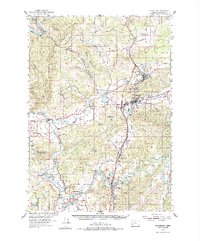
1954 Map of Sutherlin
USGS Topo · Published 1977About this map
The Umpqua River and South Umpqua River converge here, anchoring a landscape where the Southern Pacific and Camas Logging RR define the mid-century transportation network. In the heart of Douglas County, the town of Oakland sits north of Sutherlin, showing the early 1950s infrastructure of the Pacific Highway. The rural character of the area is evident in the scattered schools and places of worship, such as the Garden Valley Sch and Umpqua Ch, which served the farming and timber communities along the valleys.
Find a feature on this map
65 named features on this map. Tap any name to fly to it.
Don’t see what you’re looking for? This feature index may not catch every label — zoom into the map to look around manually.
Map Details
Editions of this 1954 Sutherlin Map
3 editions found
Other maps of this area

1897 · Roseburg
USGS Topo · 1:125,000

1900 · Roseburg
USGS Topo · 1:125,000

1928 · Sitkum
USGS Topo · 1:125,000

1954 · Dixonville
USGS Topo · 1:62,500

1954 · Sutherlin
USGS Topo · 1:62,500

1954 · Drain
USGS Topo · 1:62,500

1954 · Anlauf
USGS Topo · 1:62,500

1954 · Glide
USGS Topo · 1:62,500

1955 · Camas Valley
USGS Topo · 1:62,500

1955 · Tyee
USGS Topo · 1:62,500