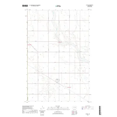
2018 Map of Sutton
USGS Topo · Published 2018About this map
Sutton serves as the primary focal point of this Eastern North Dakota landscape, situated within the agricultural expanse of Griggs Co. The settlement is defined by a grid of local thoroughfares including Main St and 1st St SE, with a diagonal Twp Rd cutting through the township. The topography is largely shaped by the meandering path of Baldhill Creek (labeled in parts as Baldhill Cr), which flows through the northern and eastern sections of the quadrangle. The surrounding terrain is a mosaic of prairie wetlands and depressions typical of the region, interspersed with a rigid network of section-line roads like 2nd St NE and 5TH St NE. This layout reflects the enduring impact of the Public Land Survey System on the development and transport patterns of the Dakotas.
Find a feature on this map
16 named features on this map. Tap any name to fly to it.
Don’t see what you’re looking for? This feature index may not catch every label — zoom into the map to look around manually.
Map Details
Editions of this 2018 Sutton Map
This is the sole edition of this map. No revisions or reprints were ever made.
Other maps of this area

1900 · Pingree
USGS Topo · 1:125,000

1951 · Kensal SE
USGS Topo · 1:24,000

1951 · Glenfield
USGS Topo · 1:24,000

1952 · New Rockford
USGS Topo · 1:250,000

1956 · New Rockford
USGS Topo · 1:250,000

1961 · McHenry
USGS Topo · 1:24,000

1961 · Binford
USGS Topo · 1:24,000

1961 · Sutton
USGS Topo · 1:24,000

1961 · Revere
USGS Topo · 1:24,000

1961 · Sutton NE
USGS Topo · 1:24,000