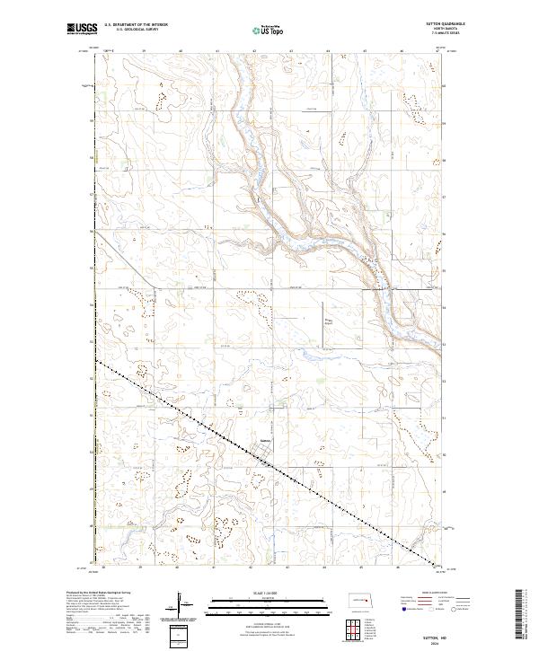
2024 Map of Sutton
USGS Topo · Published 2024About this map
Sutton serves as the central hub of this contemporary agricultural landscape in Griggs Co, situated along a grid of section-line roads and the local Main St. The topography is defined by the winding course of Baldhill Creek, which carves a distinct valley through the prairie, contrasting with the surrounding flatland used for large-scale farming. A notable specialized feature is the Stokka Airport, located just north of the town center, highlighting the importance of aerial access in this modern rural environment. The map details a well-ordered township system, including boundaries for t146n r61w and t145n r61w, which reflect the enduring Public Land Survey System that continues to organize North Dakota's geography. This survey provides a precise look at the contemporary infrastructure of the region, from county thoroughfares like Co Rd 5 to the numerous small wetlands and prairie potholes that dot the fields.
Find a feature on this map
27 named features on this map. Tap any name to fly to it.
Don’t see what you’re looking for? This feature index may not catch every label — zoom into the map to look around manually.
Map Details
Editions of this 2024 Sutton Map
This is the sole edition of this map. No revisions or reprints were ever made.
Other maps of this area

1900 · Pingree
USGS Topo · 1:125,000

1951 · Kensal SE
USGS Topo · 1:24,000

1951 · Glenfield
USGS Topo · 1:24,000

1952 · New Rockford
USGS Topo · 1:250,000

1956 · New Rockford
USGS Topo · 1:250,000

1961 · McHenry
USGS Topo · 1:24,000

1961 · Binford
USGS Topo · 1:24,000

1961 · Sutton
USGS Topo · 1:24,000

1961 · Revere
USGS Topo · 1:24,000

1961 · Sutton NE
USGS Topo · 1:24,000