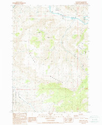
1987 Map of Sutton Mtn.
USGS Topo · Published 1988About this map
Twickenham sits along a bend of the John Day River in this high-desert landscape of north-central Oregon. The terrain is dominated by the massive landform of Sutton Mountain and the jagged profile of Packsaddle Mtn, showing a topography defined by steep canyons and seasonal drainage. In the southern portion of the sheet, the John Day Fossil Beds National Monument encompasses the area around Bridge Creek, reflecting the region's globally significant paleontological importance. The mapping reveals a sparse settlement pattern connected by 4wd tracks, where water sources like Chapman Spring and landmarks such as Goose Point were critical for navigation and ranching. Genealogists may note the small Cem located near the river, while industrial history is represented by scattered Gravel Pit and Quarry sites throughout the canyons.
Find a feature on this map
26 named features on this map. Tap any name to fly to it.
Don’t see what you’re looking for? This feature index may not catch every label — zoom into the map to look around manually.
Map Details
Editions of this 1987 Sutton Mtn. Map
This is the sole edition of this map. No revisions or reprints were ever made.
Other maps of this area

1926 · Mitchell
USGS Topo · 1:125,000

1955 · Bend
USGS Topo · 1:250,000

1957 · Bend
USGS Topo · 1:250,000

1958 · Bend
USGS Topo · 1:250,000

1966 · Mitchell
USGS Topo · 1:62,500

1966 · Kinzua
USGS Topo · 1:62,500

1966 · Clarno
USGS Topo · 1:62,500

1968 · Painted Hills
USGS Topo · 1:24,000

1968 · Lawson Mtn
USGS Topo · 1:24,000

1981 · Stephenson Mountain
USGS Topo · 1:100,000