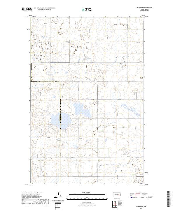
2024 Map of Sutton SW
USGS Topo · Published 2024About this map
The county line between Stutsman Co and Griggs Co bisects this stretch of the North Dakota prairie, where a strictly ordered grid of section lines and rural roads defines the landscape. Situated in the northern portion of the map, Mabel Cem serves as a primary point of interest for genealogists and local historians researching the early families of this agricultural region. The terrain is characterized by numerous seasonal wetlands and small basins scattered across township sections T145N R61W and T144N R62W, illustrating the prairie pothole geography typical of the eastern plains. A network of rural arteries, including 4th St SE and 98th Ave SE, provides access to these isolated farmsteads and fields, showing the enduring pattern of land division and settlement that has persisted into the twenty-first century.
Find a feature on this map
22 named features on this map. Tap any name to fly to it.
Don’t see what you’re looking for? This feature index may not catch every label — zoom into the map to look around manually.
Map Details
Editions of this 2024 Sutton SW Map
This is the sole edition of this map. No revisions or reprints were ever made.
Other maps of this area

1900 · Pingree
USGS Topo · 1:125,000

1951 · Courtenay
USGS Topo · 1:24,000

1951 · Kensal SE
USGS Topo · 1:24,000

1951 · Glenfield
USGS Topo · 1:24,000

1952 · New Rockford
USGS Topo · 1:250,000

1956 · New Rockford
USGS Topo · 1:250,000

1961 · Sutton
USGS Topo · 1:24,000

1961 · Revere
USGS Topo · 1:24,000

1961 · Wimbledon
USGS Topo · 1:24,000

1961 · Wimbledon NE
USGS Topo · 1:24,000