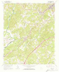
1964 Map of Suwanee
USGS Topo · Published 1973About this map
The Chattahoochee River forms a natural boundary in the west, while the growing settlements of Suwanee, Sugar Hill, and Buford define the corridor between the Southern Railway and the newly established Northeast Expressway. This 1964 field-checked map captures a landscape in transition, where legacy agricultural landmarks like Hutchins Farm Road and family-named crossings like Carrols Crossing sit alongside mid-century additions like a Drive-in Theater and the N Gwinnett High Sch.
Find a feature on this map
69 named features on this map. Tap any name to fly to it.
Don’t see what you’re looking for? This feature index may not catch every label — zoom into the map to look around manually.
Map Details
Editions of this 1964 Suwanee Map
Other maps of this area

1888 · Atlanta
USGS Topo · 1:125,000

1890 · Suwanee
USGS Topo · 1:125,000

1890 · Atlanta
USGS Topo · 1:125,000

1891 · Gainesville
USGS Topo · 1:125,000

1892 · Atlanta
USGS Topo · 1:125,000

1894 · Suwanee
USGS Topo · 1:125,000

1895 · Atlanta
USGS Topo · 1:125,000

1896 · Monroe
USGS Topo · 1:125,000

1953 · Atlanta
USGS Topo · 1:250,000

1953 · Athens
USGS Topo · 1:250,000