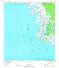
1954 Map of Suwannee
USGS Topo · Published 1967About this map
The Suwannee River delta meets the Gulf of Mexico in this detailed 1954 topographic survey, revealing a complex labyrinth of salt marshes and tidal channels. The small settlement of Suwannee sits at the heart of this aquatic landscape, where the West Pass and Suwannee Pass guide vessels through the shifting shallows of Suwannee Sound. Along the eastern edge of the map, an Old Railroad Grade serves as a reminder of earlier terrestrial industry cutting through the dense timber of the California Swamp.
Find a feature on this map
51 named features on this map. Tap any name to fly to it.
Don’t see what you’re looking for? This feature index may not catch every label — zoom into the map to look around manually.
Map Details
Editions of this 1954 Suwannee Map
4 editions found
Other maps of this area

1954 · Horseshoe Beach
USGS Topo · 1:24,000

1954 · Suwannee
USGS Topo · 1:24,000

1954 · Vista
USGS Topo · 1:24,000

1954 · East Pass
USGS Topo · 1:24,000

1954 · Gainesville
USGS Topo · 1:250,000

1955 · Cedar Key
USGS Topo · 1:24,000

1955 · Shired Island
USGS Topo · 1:24,000

1958 · Gainesville
USGS Topo · 1:250,000

1959 · Gainesville
USGS Topo · 1:250,000

1978 · Cedar Keys
USGS Topo · 1:100,000