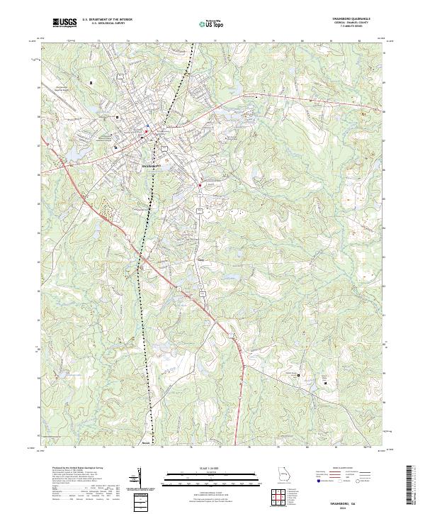
2024 Map of Swainsboro
USGS Topo · Published 2024About this map
Swainsboro serves as the central hub of this Emanuel County landscape, anchored by the Emanuel County Courthouse and the historic Swainsboro Primitive Baptist Church. This contemporary perspective of the region shows a community where education and infrastructure are prominent, featuring the East Georgia State College and the Southeastern Technical College Swainsboro Campus. The landscape is notably defined by a dense network of water bodies such as Youmans Lake and Lake India, alongside the meandering path of Canoochee Creek. To the south, the smaller settlements of Gary and Nunez are connected by the modern corridor of the Empire Expy, while local history is preserved at sites like Swainsboro City Cem and Mount Shady Cem. The surrounding terrain transitions from urban street grids to timberlands and creek basins like Yam Grandy Creek and Jacks Creek.
Find a feature on this map
167 named features on this map. Tap any name to fly to it.
Don’t see what you’re looking for? This feature index may not catch every label — zoom into the map to look around manually.
Map Details
Editions of this 2024 Swainsboro Map
This is the sole edition of this map. No revisions or reprints were ever made.
Other maps of this area

1957 · Macon
USGS Topo · 1:250,000

1958 · Macon
USGS Topo · 1:250,000

1964 · Macon
USGS Topo · 1:250,000

1970 · Covena
USGS Topo · 1:24,000

1970 · Nunez
USGS Topo · 1:24,000

1971 · Norristown
USGS Topo · 1:24,000

1971 · Stillmore
USGS Topo · 1:24,000

1971 · Swainsboro
USGS Topo · 1:24,000

1971 · Dellwood
USGS Topo · 1:24,000

1971 · Twin City
USGS Topo · 1:24,000